Remote Sensing
Jeddah Flood Remnants, Nov 2022
Overview
JEDDAH (SAUDI ARABIA) FLOOD REMNANTS, NOV 2022
On November 24, 2022 the city of Jeddah (Saadia Ariba) experienced a devastating flood killing at least 2 people and leaving many stranded. The southern part of Jeddah recorded 7.04 inches of rainfall, setting a new 24-hour record.
For this project, remote sensing was used to perform an in-depth analysis of the characteristics before and after the flood in the southern part of Jeddah. Satellite data was collected from the ESA (European Space Agency) to perform this analysis. In the following sections, we will take you through the analysis process in detail and provide the corresponding results observed.
To learn more details about this devastating flood, you can visit Floodlist.com using the following link: Floodlist.com - Saudi Arabia Flood Jeddah - Nov 2022
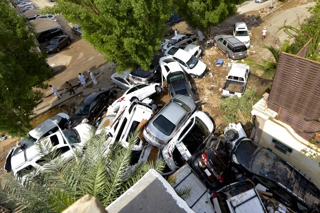
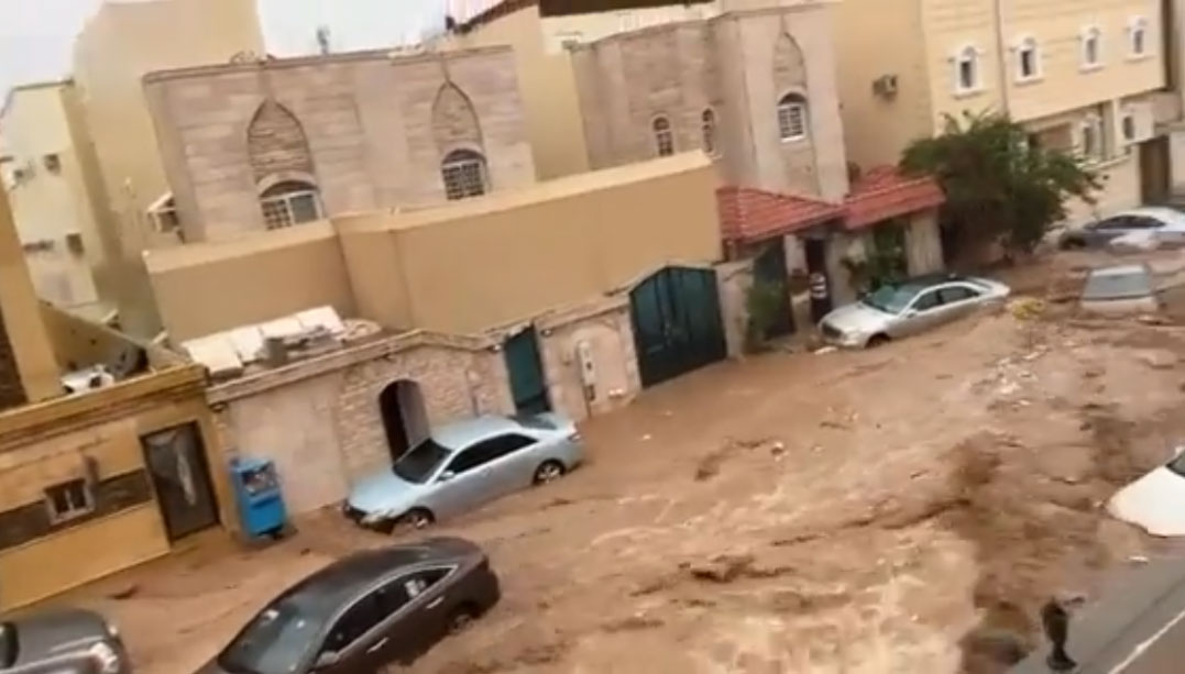
The following YouTube video provides a quick overview of the devastation.
Cars stacked up show the brute force power of the rapid flood waters.
Streets became rapid rivers quickly.
Approach
The satellite data used in this analysis was downloaded from ESA (European Space Agency) using Copernicus Open Access Hub. Sentinel-1 satellite data was processed using ESA SNAP (reference links provided below). We needed two dates to compare, one prior to the flood and another post flood. The dates selected prior to the flood was 11/17/2022 and post flood was 11/29/2022. Although the flood occurred on 11/24/2022, these two dates provided the closest available radar data available from Sentinel-1. The following actions were performed in this analysis.
- Download Data from ESA (European Space Agency) Copernicus
- Processed Sentinel-1 data using SNAP
- Performed Various Processing Methods
- Subset Analysis
- Multilook Analysis
- Radiometric Calibration Analysis
- Terrain Correction Analysis
- Reviewed Results and Completed Analysis
More Information on Sentinel-1: https://en.wikipedia.org/wiki/Sentinel-1
ESA (European Space Agency) Copernicus Open Access Hub: https://scihub.copernicus.eu/dhus/#/home
ESA SNAP (SentiNel Application Platform): https://step.esa.int/main/download/snap-download/
Analysis
Subset Analysis
What is a Subset? It's a download of a a single Sentinel-1 file that provides data for a large portion of an area we want to look at. We create a subset, or smaller area, in order to focus in on the area of interest.
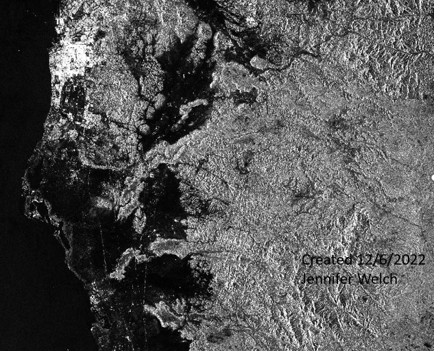
Created a subset of each radar image in the area of interest for both dates.
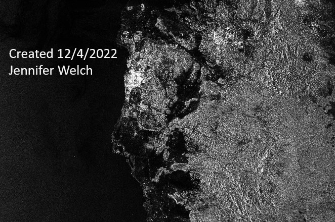
Subset 11/29/2022
Multilook Analysis
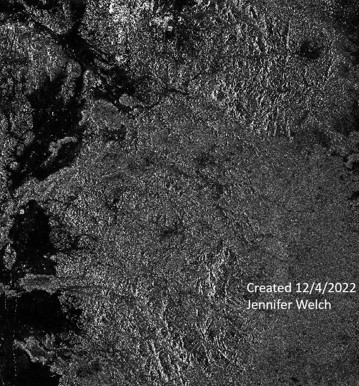
Multilooking is a filtering method that reduces speckle and decreases the spatial resolution. Filtering is used to remove noise and “smooth” out the SAR image. This step gives a wide degree of freedom to the user by allowing the user to adjust both filtering types and filtering power to their study area. When decreasing the resolution, pixel values are averaged together based on the number of range and azimuth looks; this removes high-frequency noise caused by speckle and creates square pixels. However, multilooking comes at the expense of resolution and feature edges.
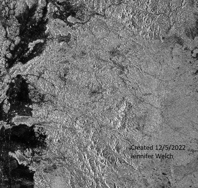
Created multilook images for both dates (I used 3 looks).
Multilook 11/17/2022
Multilook 11/29/2022
Radiometric Calibration Analysis
Radiometric calibration, also known as radiometric correction, is important to successfully convert raw digital image data from satellite or aerial sensors to a common physical scale based on known reflectance measurements taken from objects on the ground's surface.
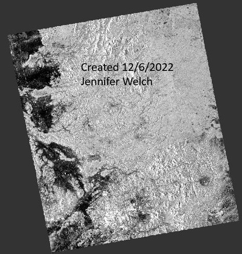
Performed a radiometric calibration to each multi-look image.
Radiometric Calibration 11/17/2022
Radiometric Calibration 11/29/2022
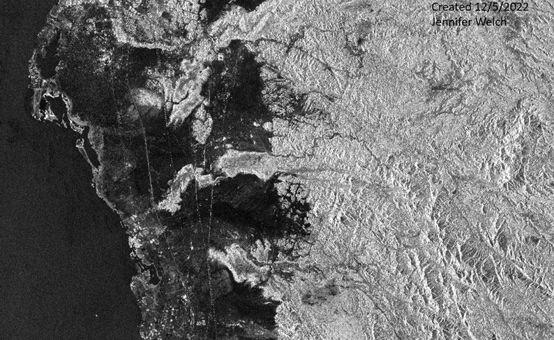
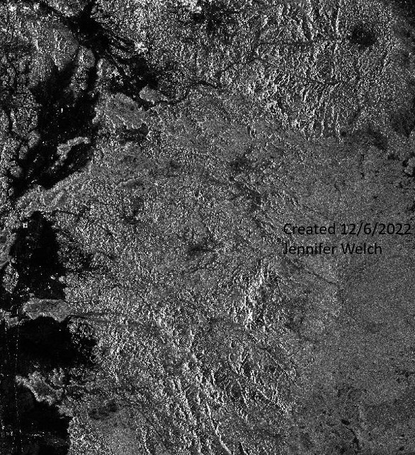
Terrain Correction Analysis
Terrain Correction corrects for geometric distortion that lead to geometric errors. Distortions can occur by side looking imaging rather than nadir imaging, and can be compounded by rugged terrain. Terrain correction moves pixels in their proper spatcial relationship.
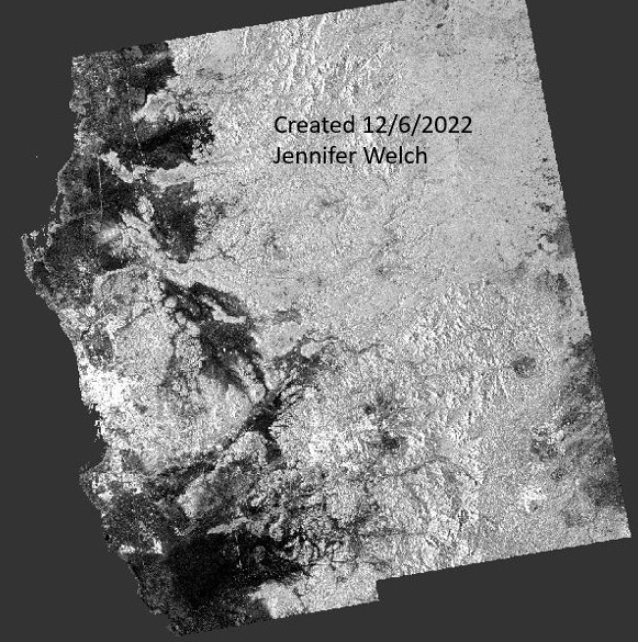
Performed terrain correction of each calibrated multi-look image and converted image from linear to decibel.
Terrain Correction 11/17/2022
Terrain Correction 11/29/2022
Co-registration Analysis
Co-registration is the process of aligning the SAR images in slant-range geometry so that a pixel from one image matches up with the pixel of the other. Co-registration corrects for relative translation shift, as well as rotational and scale differences between images. This is done by keeping the older image as the reference and adjusting the pixels in the younger image by first performing coarse (pixel level) registration, followed by fine (sub-pixel [less than 1/8 of a pixel] level) registration.
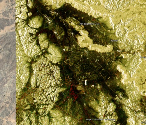
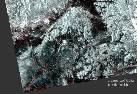
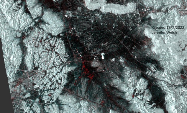
The two images below are of the stack in SNAP. The image on the left is of the southern portion of Jeddah while the one on the right is of central Jeddah. These images are of both the 11/17 and the 11//29 stacked on top of each other. The red pixels indicate remain flood water left from the 11/24 flood.
Co-register the two images into a stack with Geolocation initial offset method.
Co-registration South Jeddah
Co-registration Central Jeddah
Results
In reviewing the results of this analysis, one can quickly see the remaining water reflected in red left over after this devastating flood. The bottom two images are Google Earth images with a KMZ overlay of the Co-registered stack. With the Google Earth images underneath, we can put specific locations to the study area.
Stack RGB Composite South Jeddah
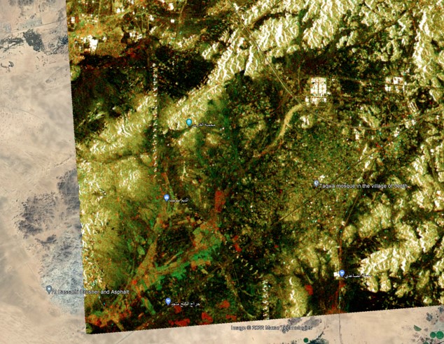
Stack RGB Composite Central Jeddah